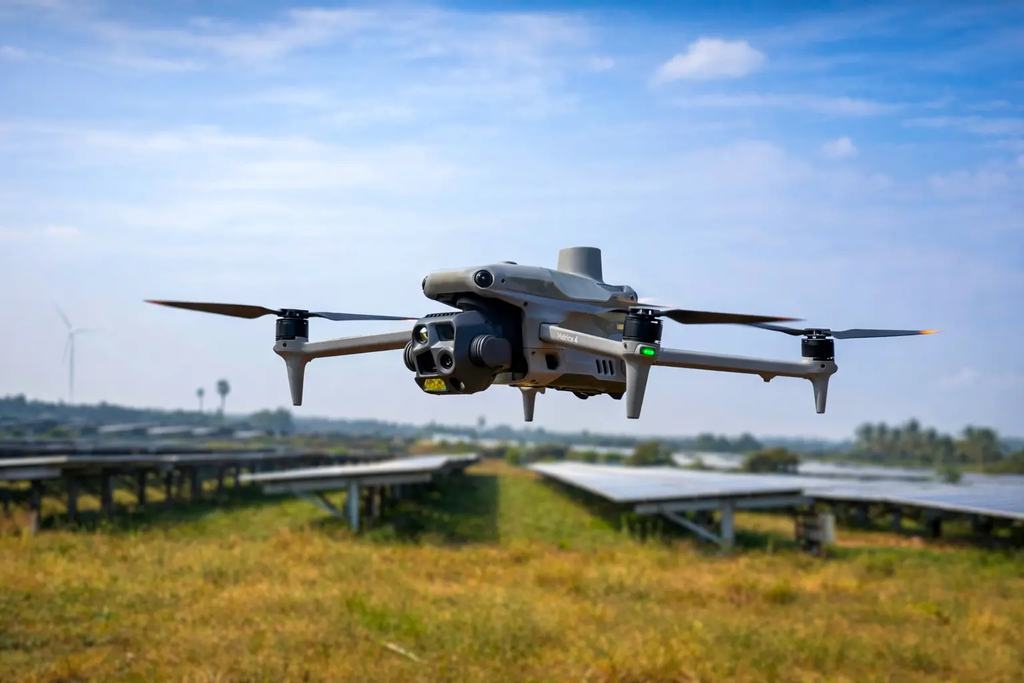
A solar park operator wants to know which panels are running hot. A mining company needs this month’s stockpile volumes. A district team wants a fresh map of a road corridor. All three need the same thing: current aerial data, captured on the ground they care about, delivered fast.
India-based Aero2Astro is building a drone data platform to meet that demand. It pairs a distributed network of verified drone pilots with geospatial processing and analytics, so an enterprise can order aerial intelligence the way it orders cloud storage.
How the Aero2Astro drone data platform works
A customer starts by marking an area of interest. If imagery for that area already exists in the platform’s library, it can be downloaded straight away.
If it does not, the customer requests a fresh capture. Aero2Astro handles the rest: pilot assignment, flight permissions, flight planning, compliance and data processing.
On the drone data platform, a dashboard tracks each job as it moves from scheduled to in flight, processing and ready. The company says a workflow can launch within 48 to 72 hours.
What customers receive
Outputs range from orthomosaic maps, digital surface models and contour maps to full inspection reports and analytics. The company says its mapping work reaches centimetre-level accuracy.
Aero2Astro has packaged these into sector platforms for solar energy, wind turbines, electricity transmission towers, mining and infrastructure. The solar product, for example, flags thermal hotspots, panel misalignment and power loss.
AerooTribe: the supply side
The pilot network runs on a sister platform, AerooTribe, a marketplace and professional network for drone pilots, surveyors and GIS specialists. Pilots find jobs, build portfolios and get paid through escrow-protected contracts.
AerooTribe also gives pilots field tools such as an airspace map for no-fly zones and weather, a coordinate converter and a GPS camera. AerooTribe’s site lists more than 500 verified pilots, over 1,200 aerial missions and more than 45 service cities.
Why a drone data platform makes sense in India now
India rewrote its drone rulebook in 2021. The Drone Rules, 2021 cut paperwork for operators, and the DGCA’s DigitalSky platform now publishes an airspace map that marks where drones may fly freely and where permission is needed.
Public programmes have also shown what drone data can do at national scale. Under the SVAMITVA scheme, drones map inhabited rural land so villagers can receive property cards.
That combination creates a market gap. Rules now allow many more commercial flights, yet most enterprises do not want to own drones, train pilots or run processing software. A drone data platform lets them buy the output without building the capability.
The fragmentation problem
Drone pilots in India are spread across towns and cities, often working alone. Enterprises with assets across many districts struggle to find, vet and coordinate them.
Aero2Astro’s answer is a drone data platform that aggregates that supply, standardises quality checks and delivers one consistent data product, wherever the asset sits.
Traction and proof
Aero2Astro is bootstrapped and at the MVP stage. Even so, the company says it has completed more than 500 successful data captures across solar, wind, power transmission, mining, infrastructure, construction and agriculture.
Its use cases span stockpile volume measurement, blast mapping, digital twins, vegetation checks along power lines, insulator diagnostics and crop monitoring. The company’s own history describes work stretching from remote villages to industrial corridors and land records modernisation projects.
The founder and the team
Ted Solomon is the founder behind Aero2Astro and leads AerooTribe as founder and chief pilot. That title matters: the platform was designed by someone who has flown the missions it now coordinates.
The company describes its origins as a small crew of pilots, engineers, GIS specialists and operations staff who travelled thousands of kilometres across India for field projects. Over time the team moved from flying drones to building the software that connects capture, processing, analytics and insight.
Why investors should watch Aero2Astro
Business model. Aero2Astro sells its drone data platform to enterprises on an on-demand basis, with a library of existing imagery adding a second revenue line from data that has already been captured. AerooTribe’s marketplace adds transaction flow on the supply side.
The wedge. Two-sided networks are hard to build. Aero2Astro already runs both sides, with enterprise demand on one platform and a pilot community on the other.
Capital efficiency. The company has reached its current scale without outside funding, which gives a future investor a cleaner cap table and a team used to tight budgets.
The next proof point. Recurring monitoring contracts with large asset owners in solar, power or mining would turn one-off captures into predictable revenue. Growth in the imagery library is the second metric to watch, because every repeat sale of stored data improves margins.
The bigger opportunity
Every solar farm, transmission line, highway and mine in India needs to be checked again and again. Aero2Astro wants to make that checking routine, priced per job and delivered in days.
If it succeeds, the company will own something more valuable than a drone fleet: a constantly refreshed record of India’s physical assets, and the network of pilots who keep it current.
For more on Indian geospatial startups, read our profiles of Indrones’ drone geospatial intelligence, AgriCPS’s satellite crop monitoring and Trinano’s solar panel coating.
FAQ
What is a drone data platform?
A drone data platform lets businesses order aerial imagery and analysis without owning drones. It manages pilots, permissions, flights and processing, then delivers maps, models or inspection reports.
What does Aero2Astro do?
Aero2Astro provides on-demand drone imagery and aerial intelligence for sectors such as solar, wind, power transmission, mining and infrastructure. Its sister platform AerooTribe connects enterprises with verified drone pilots.
Is Aero2Astro funded?
Aero2Astro is bootstrapped. It has built its enterprise platform and pilot marketplace without external investment so far.